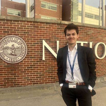
SeanPaul Padilla Profile Banner
SeanPaul Padilla Profile
SeanPaul Padilla

@invertv_dcape

5,907
Followers
902
Following
3,888
Media
15,933
Statuses

| @ousom '27, | Co-director of Training @okwxlab | Undergraduate Research Assistant @CIWRO_ | Opinions and actions are my own|

Albuquerque NM || Norman, OK
Joined February 2022
Don't wanna be here? Send us removal request.
Pinned Tweet
@invertv_dcape
SeanPaul Padilla
6 months
Tornado was just OTG east of Alta Vista KS a few moments ago. I just saw my first ever tornado
Tweet media one
38
54
439
@invertv_dcape
SeanPaul Padilla
4 months
INCREDIBLE illustration of how compact and intense this tornado was. One house barely had damage and the house next door was completely flattened. Probably one of the most impressive examples of compact subvorticies I have ever seen
Tweet media one
@JordanHallWX
Jordan Hall
4 months
Day 2 of cleanup on Greenfield, IA after a violent #tornado tore through on Tuesday. #wxtwitter #iawx @DJIGlobal
17
127
698
23
360
2K
@invertv_dcape
SeanPaul Padilla
4 months
that may be the most horrifying view of a wedge i have seen in a long long time
3
181
2K
@invertv_dcape
SeanPaul Padilla
1 year
@NostalgiaFolder Me right now praying we go back to the original Wendy's
Tweet media one
4
20
1K
@invertv_dcape
SeanPaul Padilla
2 years
What in the living hell is this.....
Tweet media one
Tweet media two
Tweet media three
Tweet media four
80
86
797
@invertv_dcape
SeanPaul Padilla
4 months
Absolutely horrifying chasing convergence on highway 281 right now
Tweet media one
27
40
571
@invertv_dcape
SeanPaul Padilla
1 year
MASSIVE TORNADO OTG via Vince Waelti's stream!
Tweet media one
16
164
555
@invertv_dcape
SeanPaul Padilla
1 year
This stuff is getting out of hand...
Tweet media one
53
43
448
@invertv_dcape
SeanPaul Padilla
5 months
Some areas in Ohio have just received a quadruple upgrade in tor probs. From less than 2% to 15%#. This may be the largest increase in tor probs from one outlook cycle I have ever seen
Tweet media one
Tweet media two
10
66
427
@invertv_dcape
SeanPaul Padilla
3 months
HOLY SHIT I GOT MY SECOND TORNADO EAST OF VICI OK.
Tweet media one
17
60
416
@invertv_dcape
SeanPaul Padilla
4 months
Well folks, This is why you never call it a "bust" before the nocturnal low-level jet/main ascent arrives. This is the 02z modeled RAP proximity profile in Ardmore OK. Extreme low-level shear combined with favorable mesoscale interactions have created a volatile environment
Tweet media one
7
64
416
@invertv_dcape
SeanPaul Padilla
1 year
What. The. Fried Hell is this?
Tweet media one
60
44
391
@invertv_dcape
SeanPaul Padilla
1 year
Incredible day today as a major and incredibly widespread tornado outbreak occured today from IA to AR. We can safely say that the HIGH and MDT risk's verified extremely well. But the SPC outlined this area 6 days out! Here is a GIF to show all outlined areas from every outlook
7
113
392
@invertv_dcape
SeanPaul Padilla
3 months
🧵This is gonna be a relatively controversial thread on what I really think about the chasing/meteorology community now that it is in my mind. Don't send me negative mail, I don't read negative mail, don't waste your time. But this is what I actually think: 1/...
40
32
397
@invertv_dcape
SeanPaul Padilla
4 months
This may be one of the strongest VROT's I have ever seen by a WSR 88-D with some very notable exceptions. You better hope this ain't hitting anything because this is likely an extremely high echelon, violent tornado
Tweet media one
11
42
390
@invertv_dcape
SeanPaul Padilla
2 months
That is the most incredible radar signature at least I have seen that is correlated with a tropical cyclone.
Tweet media one
2
50
371
@invertv_dcape
SeanPaul Padilla
1 year
Good god
Tweet media one
32
35
340
@invertv_dcape
SeanPaul Padilla
1 year
Well, here it is. The tornado that struck Matador TX has officially been rated an high-end EF3 tornado with winds of 165 mph, over a quarter mile wide and had a path length of 9.4 miles.
Tweet media one
37
83
344
@invertv_dcape
SeanPaul Padilla
4 months
We have had tornado reports every single day since April 25th.... April 25th - 10 April 26th - 101 April 27th - 46 (including the Marietta OK EF4) April 28th - 18 April 29th - 1 (random tor in eastern KS) April 30th - 14 May 1st - 17 May 2nd - 12 219 reports of tornadoes total.
2
62
348
@invertv_dcape
SeanPaul Padilla
1 year
That has to be one of the largest Day 5 risks I have ever seen.
Tweet media one
11
33
318
@invertv_dcape
SeanPaul Padilla
2 years
Can we get a bruh in comments
Tweet media one
Tweet media two
Tweet media three
Tweet media four
70
23
304
@invertv_dcape
SeanPaul Padilla
9 months
Now that 2023 is closing... What are y'all's best storm photos you have taken this year? I'll start.
Tweet media one
56
20
309
@invertv_dcape
SeanPaul Padilla
5 months
I will just say, I've seen a lot of major tornado outbreaks unfold on satellite over the past few years and this is one of those "looks" Numerous confluence bands with rapid airmass destabilization and recovery with extremely strong kinematics throught the warm sector
Tweet media one
8
56
304
@invertv_dcape
SeanPaul Padilla
1 year
Folks, go to page 134 to read about derechos. What page 134 looks like:
Tweet media one
2
22
284
@invertv_dcape
SeanPaul Padilla
1 year
And folks, I present to you the reason why we NEED basic meteorological knowledge taught to the public. It's absolutely mind-blowing to assume consipiracies and the most incredible ideas the mind can come with that twist the reality in order to conform to someone.
@MattWallace888
Matt Wallace
1 year
A MASSIVE Tornado Appeared Out of Nowhere, DESTROYED Only The Pfizer Warehouse and Nothing Else, Then DISAPPEARED Into Thin Air! MIRACULOUSLY nobody died because it happen during their lunch break. ⚠️ INSANE FOOTAGE ⚠️ HERE IS THE FULL VIDEO:
383
654
2K
26
24
282
@invertv_dcape
SeanPaul Padilla
4 months
Not good news. Really bad news. Storms are initiating in far SW OK and will likely be highly discrete given perpendicular shear vectors. These are headed right into the heart of central Oklahoma within the next several hours
Tweet media one
4
44
278
@invertv_dcape
SeanPaul Padilla
3 months
One of the hardest shots I've ever taken, especially with @tknep3 running from the tornado like a deer 😂
Tweet media one
7
29
272
@invertv_dcape
SeanPaul Padilla
4 months
This CC is one of the most omnious CC drops + debris ball combos I have ever seen
Tweet media one
2
57
268
@invertv_dcape
SeanPaul Padilla
2 months
NWS Shreveport is doing an absolutely incredible job on what must be a nightmare for them with 8+ tornado warnings and countless flash flood warnings all at one time. This is why they are degreed and do extensive warnind.decision training during these high stress situations
Tweet media one
4
42
265
@invertv_dcape
SeanPaul Padilla
4 months
Saturday has the very real potential to be the highest echelon event we have seen all year in Oklahoma, even higher than 5/6. Extreme instability combined with classical strong deep layer shear and a nearly purely discrete storm mode gives me great concern
18
35
262
@invertv_dcape
SeanPaul Padilla
1 year
Settling a debate. Left or right?
Tweet media one
Tweet media two
223
13
261
@invertv_dcape
SeanPaul Padilla
2 years
My goodness. The wording on the Little Rock AR AFD is scary. Mentions the risk for "strong to violent" tornadoes and the threat leaning towards the "worst-case scenario." Dangerous day on Thursday, especially depicted by our friends in Little Rock
Tweet media one
Tweet media two
14
61
258
@invertv_dcape
SeanPaul Padilla
1 year
We can all say... ...both HIGH risks have verified remarkably well. And we still have several more hours to go with this event. Amazing job to folks at the SPC
Tweet media one
4
44
246
@invertv_dcape
SeanPaul Padilla
1 year
Tornado that moved through Little Rock appears to have been a violent tornado based on tornado intensity guidance. Surveys will be done in later days to confirm this. Still a TOR-E remains in effect for areas northeast.
Tweet media one
6
61
246
@invertv_dcape
SeanPaul Padilla
1 year
My mother is extremely ill this evening from a severe medical condition that she has had, but is getting worse every hour. She is going to the hospital now but I'm don't know if she will make it. Please keep her in your prayers
51
7
245
@invertv_dcape
SeanPaul Padilla
6 months
Incredible cone as my first ever tornado east of Alta Vista KS. I won't forget this day.
Tweet media one
11
17
245
@invertv_dcape
SeanPaul Padilla
1 year
This is horrifying
Tweet media one
52
23
236
@invertv_dcape
SeanPaul Padilla
4 months
NWS AFD ICT (Wichita) being particularly bullish with wording mentioning that "if storms can remain even semi-discrete, strong to potentially violent tornadoes are possible." Saturday could be the real deal
Tweet media one
5
45
244
@invertv_dcape
SeanPaul Padilla
4 months
Now we are all gonna hope and pray that this discrete supercell doesn't mature with surface inhibition that is making a beeline to the OKC metro/Moore/Norman areas within the next couple hours. Because if it does mature, oh boy.
Tweet media one
Tweet media two
13
43
242
@invertv_dcape
SeanPaul Padilla
1 year
Here is a much better, higher contrast image of the incredible wedge tornado near Linneus MO today. The whole mesocyclone was practially OTG with this absolutely incredible wedge tornado. #wxtwitter
Tweet media one
@ReedTimmerUSA
Reed Timmer, PhD
1 year
TORNADO wedge intercept near Linneus, MO in Dominator 3 intercept
102
800
4K
5
59
237
@invertv_dcape
SeanPaul Padilla
1 year
🙏
Tweet media one
7
9
237
@invertv_dcape
SeanPaul Padilla
2 years
Ok.
Tweet media one
20
32
231
@invertv_dcape
SeanPaul Padilla
4 months
This is bad news in Norman. Winds are gusting to 40 mph at the surface
Tweet media one
5
11
236
@invertv_dcape
SeanPaul Padilla
5 months
The amount of transphobia I see within the Wxtwitter community is rather concerning to say the least. Lets just all get along aye?
28
17
235
@invertv_dcape
SeanPaul Padilla
1 year
We all know Ohio was the real target today...
Tweet media one
10
33
228
@invertv_dcape
SeanPaul Padilla
4 months
May have caught the tornado briefly using the IA DOT cameras southwest of Des Moines
Tweet media one
2
39
229
@invertv_dcape
SeanPaul Padilla
2 years
Bruh
Tweet media one
18
16
219
@invertv_dcape
SeanPaul Padilla
4 months
There is nothing more eerie than being at the NWC on a high risk day to take my meteorology exam
4
5
223
@invertv_dcape
SeanPaul Padilla
1 year
This may be the most violent signature I have ever seen during my time in the meteorology community. Delta-v and VROT is high-echelon, and only seen by the most violent of tornadoes. Hopefully, cell mergers from the south can disrupt the inflow but clearly a dangerous situation
Tweet media one
3
50
218
@invertv_dcape
SeanPaul Padilla
1 year
Listen, forget it's the GFS for a second... ...and Imma hop on the hype train fr. In all seriousness, this may be the more synoptically evident severe threat in a long long very long time and there is some relatively decent agreement among ensembles with this...
Tweet media one
Tweet media two
Tweet media three
Tweet media four
18
31
215
@invertv_dcape
SeanPaul Padilla
1 year
Weeeeeeeee moved in at OU and ready to GO
Tweet media one
23
0
218
@invertv_dcape
SeanPaul Padilla
4 months
Well folks, this is what has happened so far. Tornado reports from Nebraska to Texas Violent tornadoes over populated areas. Today was one for the books with one of the more incredible tornado outbreaks in Nebraska in recent memory. Prayers to all those affected
Tweet media one
6
33
217
@invertv_dcape
SeanPaul Padilla
4 months
Tomorrow is Monday In May In Oklahoma Thats the tweet
10
16
216
@invertv_dcape
SeanPaul Padilla
2 years
CWASP % is spitting out 80-85 for Day 7
Tweet media one
20
32
209
@invertv_dcape
SeanPaul Padilla
8 months
"A few strong tornadoes" That's some incredibly strong wording 4 days out from the SPC.
Tweet media one
10
36
205
@invertv_dcape
SeanPaul Padilla
3 months
Hear me out...
Tweet media one
Tweet media two
@invertv_dcape
SeanPaul Padilla
3 months
Never let HRRR cook again
Tweet media one
5
23
172
7
18
211
@invertv_dcape
SeanPaul Padilla
1 year
A violent tornado outbreak is expected today with the potential for several strong tornadoes, including potential for violent, long-track tornadoes across AR/TN and MS. A rare upgrade to a HIGH risk is expected via MCD, first time in 2 years. Big day today
Tweet media one
9
55
194
@invertv_dcape
SeanPaul Padilla
5 months
The 12z HRRR is truly one of the runs of all time in the Ohio Valley. The perfect combination of substantial instability, deep moisture and extreme LL kinematics with a line of supercells in central Ohio. If this solution were to verify, intense/long-track tors are possible
Tweet media one
Tweet media two
Tweet media three
Tweet media four
7
34
201
@invertv_dcape
SeanPaul Padilla
1 year
Large and low rotating wall clouds looking southeast from Slick OK. #okwx
Tweet media one
6
24
197
@invertv_dcape
SeanPaul Padilla
1 year
🧵 Lets talk about what the hell happened yesterday...from a meteorological POV. In this thread, we will detail what happened with this event and how one cyclic supercell spawned several tornadoes, despite merging into a line of supercells and struggling to remain discrete.
3
41
195
@invertv_dcape
SeanPaul Padilla
1 year
My new home
Tweet media one
14
1
196
@invertv_dcape
SeanPaul Padilla
2 years
All right, funs over. 00z HRRR = Holy shit Literally hinting at a widespread major tornado outbreak across LA/MS/AR/TN. Shear will be exceptional across all areas with a truly scary environment. Not to mention a fully discrete mode Lets wait for other CAMS to resolve
Tweet media one
Tweet media two
Tweet media three
Tweet media four
15
40
185
@invertv_dcape
SeanPaul Padilla
4 months
Anytime you have a synoptic pattern that even remotely looks like this in early May... ...it's defintely concerning.
Tweet media one
Tweet media two
Tweet media three
Tweet media four
2
28
191
@invertv_dcape
SeanPaul Padilla
4 months
Put it in a museum
Tweet media one
0
10
193
@invertv_dcape
SeanPaul Padilla
1 year
Thoughts and prayers go out to everybody affected today. From Rolling Forks to Winona and Silver City... ..and Amory up to Smithville. This was a day for the history books and a day to be talked about for a long long time.
2
43
184
@invertv_dcape
SeanPaul Padilla
2 years
My goodness. HRRR for tomorrow shows an extremely volitile environment for major tornadoes (with surface-based convection) across eastern TN/KY. Very strong forcing with substantial cyclogenesis leading to extreme shear with modest instability. Very high parameter spacing
Tweet media one
Tweet media two
Tweet media three
Tweet media four
18
37
181
@invertv_dcape
SeanPaul Padilla
8 months
These types of "elongated trough sizes" are notorious in Dixie for major and long-duration tornado outbreaks, mainly because of the large ridge feature in the western Atlantic and digging and already negatively tilted trough. Its quite the look synoptically.
Tweet media one
Tweet media two
Tweet media three
Tweet media four
9
34
182
@invertv_dcape
SeanPaul Padilla
4 months
Extremely concerning wording from the newest SPC outlook. "Multiple long-track and intense tornadoes are **likely**" An upgrade to a tornado driven HIGH risk is possivle pending increase in confidence in large coverage of discrete supercells capable of strong/violent tornadoes
Tweet media one
3
45
182
@invertv_dcape
SeanPaul Padilla
1 year
Fujiwhara effect Deviant Motion NW movers Cyclic tornadoes New mesos Oklahoma
7
14
182
@invertv_dcape
SeanPaul Padilla
2 years
Its happening folks Its happening
Tweet media one
17
12
183
@invertv_dcape
SeanPaul Padilla
1 year
Plains? Plains???? PLAINS!!!!!!!!!!!!!!!
Tweet media one
13
17
180
@invertv_dcape
SeanPaul Padilla
1 year
Hmmmm I'm gonna keep my mouth shut but I think y'all know what we are all thinking...
@NWSLubbock
NWS Lubbock
1 year
We appreciate your patience wrt our rating of the Matador tornado. In consultation w/ the @TTUNWI (National Wind Institute), we are working on the final details of our Public Information Statement and should have it out later this afternoon. #txwx
46
188
902
20
8
180
@invertv_dcape
SeanPaul Padilla
1 year
It's honestly shocking how much drama can arise with the WxTwitter community this early into the aftermath of a terrible event. I have absolutely nothing to say about any drama ongoing between chasers, or content creators but I just have to say... Lets all do a bit better
14
18
179
@invertv_dcape
SeanPaul Padilla
1 year
Idalia is organizing fast. And I mean FAST. A clear CDO evident with the newest NHC update increasing sustained winds by 15 mph and increasing intensity at landfall is serious stuff. Idalia means business
9
19
178
@invertv_dcape
SeanPaul Padilla
1 year
Considerably strong wording regarding the southern upgrade to a MDT risk in this latest Day 2 outlook. Despite capping concerns throughout most of the day, significant concern is evident for strong tors given a high-end parameter space. Hence, the SPC is taking it seriously.
Tweet media one
5
35
181
@invertv_dcape
SeanPaul Padilla
3 months
When it starts to affect your personal and academic life, its time you tell yourself to PUT A LIMIT. Burnout is real, especially in meteorology. Don't put yourself or others in danger because of it. Thanks for reading my TEDTalk
15
0
183
@invertv_dcape
SeanPaul Padilla
4 months
This page hits different when you are in the target zone
Tweet media one
4
7
180
@invertv_dcape
SeanPaul Padilla
2 years
YES I GOT ACCEPTED TO OU!!
27
2
175
@invertv_dcape
SeanPaul Padilla
4 months
This satellite imagery is rather concerning. Breaks in the clouds south of storm activity with overall convection being relatively sparse and north of the WS has me deeply concerned about this afternoon. Strong/violent tornadoes are possible today across central Oklahoma
Tweet media one
4
34
177
@invertv_dcape
SeanPaul Padilla
1 year
Incredible RaXPol loop from The 2013 El Reno tornado depicting an incredible central vortex and several satellite tornadoes rotating (and the Fujiwhara effect) around the main vortex. Arguably should have been rated an EF5 based on this data given 290 mph near-surface winds
5
32
174
@invertv_dcape
SeanPaul Padilla
2 years
This "forgotten F5" was an incredibly destructive tornado that destroyed numerous structures in this town. Another example of weak low-level flow with southeasterly propagation and ingestion of streamwise low-level SRH. CIMSS did amazing research on this. What tornado was this?
Tweet media one
Tweet media two
Tweet media three
Tweet media four
22
9
173
@invertv_dcape
SeanPaul Padilla
6 months
I finally was able to stabilize my time lapse of updrafts blossoming in eastern Oklahoma. 📍Slick OK September 23, 2023
4
21
176
@invertv_dcape
SeanPaul Padilla
1 year
I could not be happier with my first ever chase results. With seeing my first ever supercell up close and personal was an unbelievable experience. September 23rd, 2023 - Slick OK
Tweet media one
4
10
174
@invertv_dcape
SeanPaul Padilla
1 year
Why does it seem like the general public is getting less and less informed, educated and mindful of severe weather events despite so much advancement in technology and wide access to weather information? I feels like people in the 80's and 90's would have been better informed.
30
13
172
@invertv_dcape
SeanPaul Padilla
3 months
nvm
@invertv_dcape
SeanPaul Padilla
3 months
Today went from being potentially historic to kinda mid 😅 No one is complaining
27
3
134
16
4
175
@invertv_dcape
SeanPaul Padilla
1 year
Ho Lee sheet Absolutely incredible supercell looking east from Bristow OK #okwx
Tweet media one
3
24
174
@invertv_dcape
SeanPaul Padilla
3 months
Never let HRRR cook again
Tweet media one
5
23
172
@invertv_dcape
SeanPaul Padilla
4 months
Since I got a full structure shot this evening of a mini supercell, here is a simple, real-life example of its structure and main details of it.
Tweet media one
0
14
175
@invertv_dcape
SeanPaul Padilla
1 year
Magnitude 5.1 earthquake in SoCal Tropical Storm Hilary impacting SoCal Tornado threat in SoCal Flash Flood threat in SoCal Just an average day in SoCal
Tweet media one
Tweet media two
Tweet media three
Tweet media four
9
30
170
@invertv_dcape
SeanPaul Padilla
2 months
Put it in the books July 1st 2024
Tweet media one
3
24
171
@invertv_dcape
SeanPaul Padilla
7 months
Appears that the Evansville WI tornado from yesterday has just got a DI of an EF3 140. Some of the photos attached as well...
Tweet media one
Tweet media two
Tweet media three
Tweet media four
4
34
168
@invertv_dcape
SeanPaul Padilla
1 year
Another very large Day 7 15% risk across the Mid-South where the SPC mention the possibility of "potentially widespread severe weather." This does look like one of the largest Day 7 risks I have ever seen, but someone from the SPC would have to double check that idea.
Tweet media one
9
21
167
@invertv_dcape
SeanPaul Padilla
1 year
Synoptically speaking, Tuesday appears to be a high-echelon severe weather day. Very large, enhanced longwave trough with substantial moisture advection and a stout LLJ. Mesoscale early concerns are evident (overmixing/early 700 mb perturbation), but its still to early to tell.
Tweet media one
Tweet media two
Tweet media three
Tweet media four
8
25
167
@invertv_dcape
SeanPaul Padilla
4 months
For people in the OKC metro, please don't look at the 06z HRRR run. It actually scares me
5
7
163
@invertv_dcape
SeanPaul Padilla
4 months
A composite of profiles via NAM in central Oklahoma by 00z is just creepy. 00z OUN 5/7/24 about to be the most incredible observed profile seen in a long time
Tweet media one
4
19
163
@invertv_dcape
SeanPaul Padilla
4 months
Warm sector from hell
Tweet media one
7
10
161
@invertv_dcape
SeanPaul Padilla
4 months
Environment near the violent tornado that hit Greenfield IA earlier depicted by WoFS. No words needed
Tweet media one
9
30
161
@invertv_dcape
SeanPaul Padilla
1 year
Goodness gracious. MAJOR tornado OTG near Bancroft GA! Extremely large TDS!
Tweet media one
@invertv_dcape
SeanPaul Padilla
1 year
Thats not good...
Tweet media one
1
10
56
3
29
157
@invertv_dcape
SeanPaul Padilla
4 months
Forget the ratings all together for a second. The real question is why tf we can't have well constructed structures everywhere and/or built up to code instead of construction companies cutting corners to save on materials. That's the real issue
14
14
157
@invertv_dcape
SeanPaul Padilla
11 months
Class, go to page 343 in the Synoptic Meteorology textbook for an example of an omega block. The textbook:
Tweet media one
7
6
155