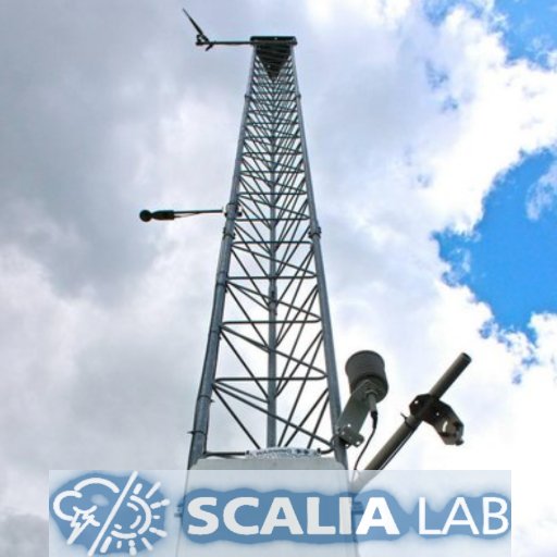
Scalia Laboratory for Atmospheric Analysis is a meteorological forecasting and research facility on Ohio University's campus. Wx Hotline: 740-593-1717
#ohiouwx
Very strong rotation and reports of a tornado on the ground in Athens county Ohio. TAKE SHELTER IN THE PATH OF THIS STORM IMMEDIATELY.
#ohiouwx
#ohwx
@NWSCharlestonWV
!
Observed potential spinup-tornado from Joee Green at 7:28 PM EST, facing westward from Stagecoach Road, Athens County Ohio.
#OHwx
@NWSCharlestonWV
๐ฅ Credit: Joee Green
Good Morning Everyone! Here is our updated snow forecast. Look for heavy snow to move in this afternoon and continue into the overnight hours, totaling 6"-9"+. Travel will be impossible and wet snow may cause power outage risks as well.
#OHwx
#ohiouwx
(1/2)
From the staff here at Scalia Lab, we want to say thank you for helping us hit 1,000 followers! We appreciate your support over the years and look forward to providing weather information for Athens and southeast Ohio for years to come!
#ohwx
#ohiouwx
OPENING WEEKEND FORECAST:
A few showers will linger into the morning hours on Friday but we should dry out heading into the afternoon. Finally some relief from the heat with lower humidity and cooler temps giving us pleasant and dry conditions for the entire weekend!
Check out the temperature drop at about 2am in Athens! Wow! This is when the cold front arrived, bringing the snow, strong winds, and bitter cold temperatures. The minimum temperature reached as of now occurred at 9:47am, with a temperature of -2.4 degrees Fahrenheit!
Good Evening Everyone! Here is our updated snowfall forecast for Sunday into Monday. It appears likely that far Southeastern
#Ohio
, Athens included, can pick up 6"- 9" totals. Travel will be impossible and risk of power outage is there due to heavy wet snow.
#OHwx
#ohiouwx
(1/2)
๐ผOHIO BOBCATS FOOTBALL FORECAST:
Saturday looks like another beautiful day in Athens! We will see some morning clouds burn off by game time leaving us with partly cloudy skies and temperatures near 80 for the whole game!
#ohwx
#ohiouwx
#GoBobcats
The National Weather Service has issued a Winter Storm Watch for Sunday into Monday for all of southeast Ohio. A winter storm is expected to track near the region, putting the region on its cold side and bringing the potential for heavy snow. Stay tuned!
#ohwx
#ohiouwx
โญ๏ธCheck out this awesome article from Ohio Today about Meteorology Professor Dr. Jana Houser. Houser was awarded the 2019 University Professor for her excellent connection with her students and teaching style.
Congratulations to our director, Dr. Ryan L. Fogt, for being chosen as a coordinator for one of Ohio University's new Sustainability Hubs! We look forward to increased sustainability literacy and programs in the coming months.
Dr. David J. Bayless, Dr. Theresa Moran and Dr. Ryan L. Fogt will lead the Universityโs new Sustainability Hubs. Their appointments are part of a campus restructuring plan to elevate sustainability efforts within every college, department and division.
[6:30pm] Athens has finally switched over to snow. While sleet may still mix in every once in a while, most of the region should remain mostly snow through the night, accumulating quickly (perhaps 1"+ per hour at times). Several inches will fall before daybreak
#ohwx
Tornado warned cell headed towards Athens county. Be sure to heed any warnings, listen for sirens, and make use of your local news channel or weather radio if you own one! Stay safe.
#ohwx
#ohiouwx
Good afternoon Athens! The first major snowfall of the season will occur tomorrow. A low pressure will track through the Appalachian Mountain area, with our area being to the north of the system. Total snow accumulation of 1"-3" can be expected, with 3"-5"+ further south.
#ohwx
The bitter cold temps that will arrive with the winter storm is what is called a "Siberian Express" pattern. This occurs when a large area of high pressure moves into Siberia, forcing all the cold air out and following a clockwise pattern from the Arctic down into the U.S. (1/2)
The tornado we had in Athens on 8/12 was certainly a special one! Read more about how Athens Countyโs 7th ever recorded tornado, and the first since 2018, came to be in Scalia Labโs first EVER case study here:
A DANGEROUS THUNDERSTORM is heading for Athens county and city area. BE PREPARED in case of a tornado warning as this storm has a tornadic history.
#ohiouniversity
#ohiouwx
#OHwx
@ohiou
While the tornado warning is canceled for Athens county, there are more storm cells near us near within 15-20 minutes which are also showing rotation so please please be cautious.
#OHwx
#ohiouwx
You might be noticing a persistent haze in the sky this morning and it's all thanks to fires over 1000 miles away! This map shows the smoke in the atmosphere shifting over our region as a result of the wildfires out west.
#ohwx
Update on upcoming winter weather:
Thereโs still some unknowns regarding this system but hereโs what we know:
โข Extremely cold temperatures, and even colder wind chills.
โข Blizzard like conditions possible with wind gusts at 40-50mph.
โข Approximately 1-3โ of snow
#ohwx
[7:15pm] Athens County is up to a level 2 snow emergency. Roads are becoming very treacherous to impassable as heavy snow continues to fall. Stay off the roads unless absolutely necessary!
#ohwx
Tornado Warning: Approximate timing. Should be in the city of Athens in the next 5-10 min. Please seek shelter immediately on the lowest floor, in most interior portion of the building away from windows
Here's our first snowfall forecast for southeastern Ohio for Sunday evening through Monday morning. Several inches (5-8") looks to be possible across much of the region, especially near and east of Athens. Some sleet may mix in at times. Stay tuned for more updates!
#OHwx
#ohiowx
The strongest line of storms is moving in now and looks to be strengthening. As a reminder, all hazards are possible including tornadoes, so please stay weather aware!
#ohwx
#ohiouniversity
Good Morning everyone! Winter storm watch is issued for Entire southeastern
#Ohio
, including Athens co, for potential of significant icing on top of couple of inches of snow. Alert goes in effect 9pm Wednesday night through 10am Friday.
#OHwx
#ohiouwx
RLX issues Winter Storm Watch valid at Feb 2, 9:00 PM EST (issues Athens, Morgan, Perry, Vinton [OH], issues Boyd, Carter, Greenup [KY] and Gallia, Jackson, Lawrence, Meigs, Washington [OH]) till Feb 4, 10:00 AM EST
Reported snow totals in SE Ohio. 8โ Athens, 8.5โ Hickory Hills, 7.5โ McArthur, 7.5โ Caldwell, 5โ Sugar Grove. Please send us your snow totals, include the city name in your post and a picture of a ruler in the snow if you can. Make sure not measure in drifts.
#OHwx
#ohiouwx
From lab director Dr. Ryan Fogt. Unfortunately, a significant and very impactful ice storm is looking more and more likely for Southeast Ohio, with potential for power outages, downed limbs/power lines, and impossible travel
@CityofAthensOH
@ohiou
@AthensEMA
#ohwx
#ohiouwx
Athens is under an enhanced risk (3/5) for severe weather Wednesday afternoon and evening. The main risk is damaging winds, but isolated tornadoes are also possible. Make sure to stay weather aware tomorrow!
#wx
[3:52PM] Here is a current look at the radar. Storms, some tornado warned, are quickly approaching the SE OH region. Stay tuned for updates on any watches/warnings posted.
#ohwx
A severe thunderstorm warning has been extended into Athens County. 60 mile an hour wind gusts and nickel sized hail are possible. The storm does have a history of producing tornadoes, so please stay aware!
#ohwx
#ohiouniversity
Today begins the future of
#ohiouwx
, ushering in a new Scalia Lab staff! Logan Clark as Associate Director, Austin Patrick as Lead Forecaster, and Andrea Lorek as Webmaster
#GoodLuck
July means a new staff is introduced and our graduates say goodbye to the lab. Today, we'll take a break from the weather to celebrate our three graduates as they enter the next chapter of life. We'll introduce the new staff over the next couple days as well.
๐Happy
#NationalWeatherpersonsDay
Shoutout to meteorologistโs in all sectors for all your hard work you do to provide accurate and timely forecasts to the public! โ๏ธโโ๏ธ
#ohiowx
Forecast Verification: overall, most of the region saw a general 6-9", in line with our forecast. The heaviest totals were seen north and east of Athens, while locations back west towards central Ohio saw lesser amounts, as was expected.
#ohwx
#ohiouwx
The NEW is officially up and running! Make sure to check out the new website, with new forecast graphics and an updated design. A huge thank you to
@RedtailDesignCo
for a great build!
#ohiouwx
It's going to be a rainy Veterans Day tomorrow! Remnants of Nicole will push their way into the region overnight and into the early morning and will continue to dump rain on the region through the evening Friday. Highest rainfall totals will lie along the I-71 corridor.
#ohwx
[8:20pm] The rotation has moved east of Athens and the tornado warning has been canceled. However, broad rotation near Guysville is still tracking east towards eastern Athens Co, Washington Co, and Parkersburg WV. There is another round behind this moving in the next hour or so
It's Homecoming Week! And what better way to celebrate than with some clear, crisp, fall weather! We're looking at mostly sunny skies and about average temperatures for the whole week. Temperatures at night will drop to the 40s. Some frost could be seen on the weekend mornings.
We're nearing the time for peak colors in southeast Ohio, so we're opening a photo contest! Share with us your Fall photos by replying/retweeting. The winning picture will be featured as our profile's banner photo!
Submissions will close on Friday, October 21.
#ohiouwx
#OHwx
A TORNADO WATCH has been issued until 2:00 AM EDT by the SPC. Primary threats are A FEW TORNADOES LIKELY as well as other hazards.
Remember, a WATCH means conditions favorable for severe thunderstorms that can produce tornadoes, and to be prepared for a warning.
@ohiou
#OHwx
Another storm is approaching behind this first tornado-warned storm, with a warning issued for Vinton and Athens Counties until 9pm for 60 mph wind gusts
#ohwx
Rotation is being maintained with a cell approaching Athens county. The track of the storm looks to be coming right over city of Athens. Make sure to heed this warning as this nears our area.
#OHwx
#ohiouwx
Happy Game Day in Athens! The Bobcats are back home for some Tuesday night
#MACtion
as they take on Buffalo for first place in the MAC. Aside from cloudy skies, temperatures will be pleasant. Stand Up and Cheer and support our Bobcats on this beautiful fall night!
#ohwx
#ohiouwx
Athens county is now under a level 3 snow emergency which means that roads are closed to non emergency vehicles. Travel is only allow only if there is an emergency.
#OHwx
#ohiouwx
Happy Homecoming Weekend!
@OhioFootball
is back at Peden Stadium today as the Bobcats take on Central Michigan! Temps will be in the low to mid 70s throughout with partly to mostly cloudy conditions. Chances for rain should dissipate by morning. Go Bobcats!
#ohwx
#ohiouwx
Have you noticed our warming Climate? Hereโs a depiction showing above average temperature years in Red๐ด, below avg. in Blue๐ต in Ohio and Globally. Does anyone see the trend?
#ShowYourStripes
#MetsUnite
#ohwx
RECORD HIGH:
Today (2/03/2020) has a new record high temperature (Keep in mind we should be in the upper 30s for this time of the year...)
The area will continue to see above average temperatures with the return of rain and clouds through Friday.
#ohiowx
#ohiouwx
An Ice Storm Warning is in effect for portions of southeast Ohio until 10 AM Tuesday. Major impacts are expected in red areas. Expect power outages, trees & power lines down, & extremely poor road conditions. Travel is not recommended in the red areas after 4 PM
#ohwx
#ohiouwx
A major winter storm is approaching the region, with rain changing to a prolonged icing event by noon tomorrow. Freezing rain changes to sleet by evening, then snow overnight. Heavy amounts of ice could lead to power outages, tree limb damage, and make travel impossible
#ohwx
Good Afternoon Everyone! Below is our forecast for freezing rain on Thursday. We will start out as rain on Wednesday, amounting to 1", before we changeover to freezing rain sometime Thursday morning. Significant ice appears likely in parts of southeast Ohio.
#OHwx
#ohiouwx
(1/3)
Wednesday Severe Weather Threat:
Currently the majority of Ohio is under a slight risk for severe weather for Wednesday.
Main Threats:
Damaging Winds๐ฌ๏ธ
Large Hail
Brief Iso. Tornado Possible๐ช๏ธ
Timing:
Late afternoon into the evening hours.
Stay Weather Aware!
#ohwx
A developing low pressure system will reintroduce the chance of severe weather. Today, showers/storms will stay mainly west, but storms will develop and move across Southeast OH Thurs PM. Damaging winds would be the primary threat; hail or a tornado are also possible.
#ohwx
TORNADO WARNING for Athens until 2:30 AM. A tornado watch also remains in effect until 4:00 AM as conditions remain favorable for severe weather.
#ohwx
#ohiouwx
Welcome new Ohio University students! ๐Here's your forecast for scheduled move-in days: Non-severe showers and storms on Thursday. A return to slight chances for diurnal showers and storms through the weekend, primarily ~3-8pm. Make sure to have a raincoat!
#ohiouwx
#ohiowx
IT'S GAMEDAY BOBCATS!!
It will be a chilly November evening here in Athens for the football game. Bundle up and come out to support your Bobcats as they battle W Michigan for the final game home game of the season!
@ohiou
@OhioFootball
#ohwx
#ohiouwx
๐ฅRECORD FALL HEAT:๐
This week is proving to be one for the record books... we broke the record yesterday and have exceed the record for today by 5 degrees. The hot and humid conditions look to stick around through Thursday. Stay cool and hydrated everyone!
#ohiowx
Much of Ohio is yet again under the gun for severe weather tomorrow with a threat for tornadoes and high winds with thunderstorms. Much of the risk is focused on Southeast Ohio and parts of WV. Make sure to prepare NOW for the possibility of severe weather.
#OHwx
#ohiouwx
As we enter the evening hours, and this system approaches, we want to reiterate that snow accumulation is NOT the biggest threat when it comes to travel with this storm, the flash freeze, combined with blowing and drifting snow will be.
#ohwx
The Tornado Watch has been CANCELLED for much of our coverage area (including Athens County), however the threat for severe weather still continues through some of southeast Ohio into PA and West Virginia. Stay tuned to
@NWSCharlestonWV
for updates!
#OHwx
#ohiouwx
@ohiou
Here is your OU football forecast for today! We're still a bit chilly today due to westerly flow and high pressure. By kickoff we'll only be in the upper 50s, peaking at near 60 later in the evening. Winds should be light with cloudiness throughout the day.
#ohwx
#ohiouwx
Looking at current radar, snow has moved out with drizzle now falling as temperatures have warmed up just above freezing here. We recorded 1.3โ of new snow here in Athens Campus today. We would love to know how much new snowfall southeast Ohio area has recived.
#OHwx
#ohiouwx
If you have any last minute preparations to make, we recommend to do so before 2pm. Snow rates this evening will be 1"+ per hour at times.
#OHwx
#ohiouwx
(2/2)
Hello everyone! We are happy to announce a new page on our website "Basic Meteorology". This page provides basic information about weather and forecasting terms that we typically use. Feel free to check it out below!
Tornado Warning issued for Athens County, including the city of Athens and Ohio University. Rotation is near Carbondale moving east towards the city of Athens. Please seek shelter immediately with this storm!
#ohwx
Moderate showers and thunderstorms are moving into the area. We are monitoring for higher severe potential with some of these, but the main threat is expected to be later.
#OHwx
#ohiouwx
SEVERE WEATHER UPDATE: A significant severe weather event is expected across the state tomorrow with ALL HAZARDS on the table. Now is the time to make preparations for severe weather. Find important safety tips here: !
The Winter Storm Warning has been upgraded to an Ice Storm Warning for Athens, Vinton, Morgan and Jackson counties until 7 am tomorrow. The Flood Watch still remains in effect until 1 am. A transition to freezing rain is expected sometime this afternoon.
@ohiou
#ohwx
#ohiouwx
Awesome shots of approaching cells out to our west! Expect periods of showers and storms this evening and during the overnight hours with a cold front approaching.
#ohwx
#ohiouwx
This week is going to be beautiful for the Athens area! We're starting off the week with mid-70s highs and around 40 for lows with sunny and clear skies and calm winds! Enjoy!
Forecast provided by
@hailhavocwx
at
(12PM) Updated ice and snow forecasts from
@NWSCharlestonWV
. Even a glazing of ice (>0.1โ) is enough to coat roads and sidewalks, so be prepared tomorrow morning!
#ohwx
#ohiouwx
@ohiou
Notice a bit of haze outside? Smoke from the fires out west has traversed all the way across the country and mixed into our region! Gray/hazy skies stick around today and tomorrow before a cold front pushes the smoke/haze out. Watch out for more pronounced sunrises/sunsets!
#ohwx
NEW WEBSITE, COMING THU JULY 12TH.
will transition to a new website, with improved graphics and design features, and now mobile friendly! Stay tuned for the latest details during this exciting time
#ohiouwx