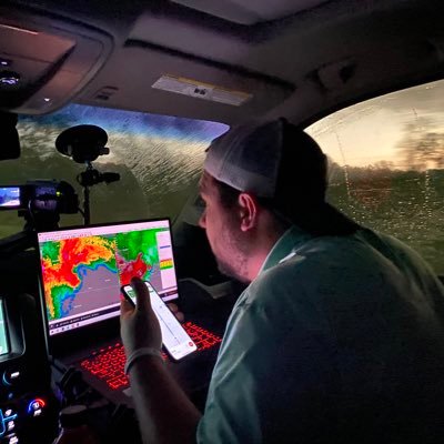
Maybe it’s something or maybe it’s not, but it was creepy enough to send chills up and down my spine. This picture of my wife was taken on the last day of our anniversary trip at Grand Teton National Park near the end of August.
#GabbyPetito
@FBI
I have a sick feeling that today is going to be a day that folks in this area are going to talk about for many many years. SPC has pulled the trigger on the very rare high risk. I’m begging everyone if you live in the threat area, please take today seriously and have multiple
I'm not going to sugar coat this. We are looking at possibly the largest tornado outbreak we've seen in the past 10 years. PLEASE take all warnings seriously today!
I know there were a lot of storm chasers who saw their first fatality last night. As someone who’s seen quite a few, it never gets easier, but I wish I would have talked to someone about it after I saw my first years ago. Feel free to reach out to me if you need to talk.
The tornado threat has significantly increased as it appears like morning convection will have little, if any, impact on an already volatile tornado environment.
This could be a day that folks will talk about for many years. Please have multiple ways to get warnings!
#okwx
Still going through some of my footage from the chase last night and I think this is the best photo I took. During the video you can actually see horizontal vortices wrapping around the tornado, which is typically indicative of a violent tornado.
#Hayti
Honest post—I went back and watched some chasers live streams to better understand why the police in Taylor County, Florida were being so aggressive threatening arrest. After watching the streams, I can understand why the officers were so upset. We must start holding reckless
It’s been a while since we’ve had a large hurricane in terms of size. The hurricanes we’ve had over the last few years have been smaller/buzzsaw type storms. While those storms are catastrophic, the impacts are over a smaller area. If the GFS is accurate, this next system would
I can't stress this enough--If you live in a mobile home PLEASE either go to a friend/family members house or just stay at a storm shelter. Your chance of surviving tornadoes like we are going to have today is nearly zero. Mobile homes are death traps on days like this!!
This is the view I had looking out the rearview window of my car on this day 12 years ago in Tuscaloosa, AL. While the trees have grown back and people have rebuilt, the scars are still visible from that day. I think about that day regularly.
Latest 12z hurricane models are still printing a very dangerous scenario. All hurricane models are now showing a strong category 4/borderline cat 5 at landfall. Still uncertainty, but this is a troubling signal.
#HurricaneHelene
This is an awful take. I had multiple people come up and talk to me today who said they found me through RHY and shared their stories about how his broadcasts made them more weather aware.
In the end, isn’t it the goal to get the word out and make people more weather aware?
I’d just like to give a huge thank you to folks that help clean up after natural disasters. A major hurricane made landfall a couple hours ago and I’ve already seen power line crews, bulldozers, tree removal services, etc out helping people. Incredible!
Just a heads up...I know there will be a lot of chasers who will be chasing a hurricane for the first time. If you try to chase on the Florida coast from Alligator Point to Cedar Key, it's a death wish. You won't survive. Stay away from the Big Bend area!
Not naming names, but why is there such a hero/savior complex with a certain very small group of chasers? What happened to helping people out because it’s the decent thing to do? Instead it’s more about taking pictures, and saying look at me I’m being a good person.
PARTICULARY DANGEROUS SITUATION(PDS) Tornado watch is out!! PDS tornado watches are rare and are only put out on extremely dangerous setups. PLEASE be weather aware today and have more than one way to get warnings. Tornadoes today will be a threat to both life and property.
#okwx
These are the best two candidates we could find? 336 million people in the US, and this is who we have to chose from. Tonight we are all losers…
This is my one and only political tweet for the year. Back to the weather…
Ever seen a lightning strike go right through the funnel of a tornado? Now you have…This is the tornado that we closely intercepted in Crowell, TX!!
@ryanhallyall
@NWSNorman
#txwx
Water at Charlotte Harbor is being taken out to sea. The only time I’ve seen it to this level is during a tsunami. HUGE storm surge imminent when wind direction changes!
#HurricanIan
Finally getting a chance to look back at some of my footage from last night and just wow! I have no words. This was taken looking north as the tornado crossed I-55 just south of city of Hayti, MO.
Here’s the tornado we intercepted as it was going through Winona, MS. It appears like it was lifting, and that would validate why there isn’t much structural damage in the city.
#mswx
@NWSJacksonMS
Remember when I said the second intercept of that tornado near Winnsboro, TX was even more intense? Here the tornado after the tornado cycled and put down a stovepipe with horizontal vortices. Uploading YT video shortly!!
#txwx
Look who’s feeding on her own! Also, she was able to get her IV removed this morning. Hopefully only a couple more days till she’s ready to be discharged from the NICU and come home!
Moderate risk upgrade for the threat of "SEVERAL STRONG TORNADOES AND A FEW LONG-TRACK EF3+ TORNADOES".
Very dangerous day setting up today across tornado alley. Leaving KC in the morning and targeting the OKC area. Stay weather aware!
The hurricane models are in, and this is an extremely concerning signal. ALL hurricane models are showing a major hurricane(category 3+) at landfall somewhere along the Florida coast later this week. Take these next couple days to prepare if you live in this area!
This was likely my last chase until Spring 2024 since our new baby girl will be born any day now, and that takes top priority. If this was my last chase for 2023, what a heck of a year it’s been! Much love and I’ll see you all in 2024! 🌪️ ⛈️
Tomorrow is trending in a very bad direction. Becoming increasingly concerned for folks in Kansas and Oklahoma. VERY high ceiling for tomorrow! Now is the time to start planning and making sure to have multiple ways to get warnings!
#kswx
#okwx
High risk is out! Goal today is ZERO fatalities. I beg each and every one of you to contact your family/friends in this area and let them know the significance of this threat!
A new PDS tornado watch has been issued for the threat area where we expect numerous significant/violent(EF4+) tornadoes today! PDS stands for particularly dangerous situation and are only issued for the highest of high days. Stay safe today everyone!
#okwx
#kswx
Yesterday was one of the worst days of my life. After only 4.5 years, Cooper crossed over the rainbow bridge. Cooper brought so much joy to our family. I hope he knows just how much he was truly loved by everyone that knew him. He was and will always be the bestest boy.
Ended up sitting today’s chase out. It wouldn’t have been safe to drive 12+ hours overnight with no sleep and then turn around and chase. Instead today is a travel day to get in position to chase the significant tornado threat tomorrow. Stay safe if you’re in the threat area
Beginning to become concerned about the severe weather threat on Monday! There’s a severe threat for both Monday and Tuesday, but Monday has my full attention at this point.
If you live in a mobile home, you still have time to go to a storm shelter or to a friends house. If you are in a mobile home, and get hit by a tornado today, you likely will not live to tell the story about it. Mobile homes are death traps!
Rain wrapped significant tornado just crossed in front of us on HWY 8 near Deer Park, TX. Checked on the driver of an overturned 18 wheeler and he is okay. Visible roof damage to commercial and residential structures. Repositioning now and heading east on I-10.
@NWSHouston